
The Kettle Valley Rail Trail at a glance
The Kettle Valley Rail Trail is a walking and cycling route on the bed of the former Kettle Valley Railway. It is not one smooth, continuous path. Some sections are popular day rides, others are closed for safety, and the Myra Canyon trestles lie in a different park, Myra-Bellevue Park.
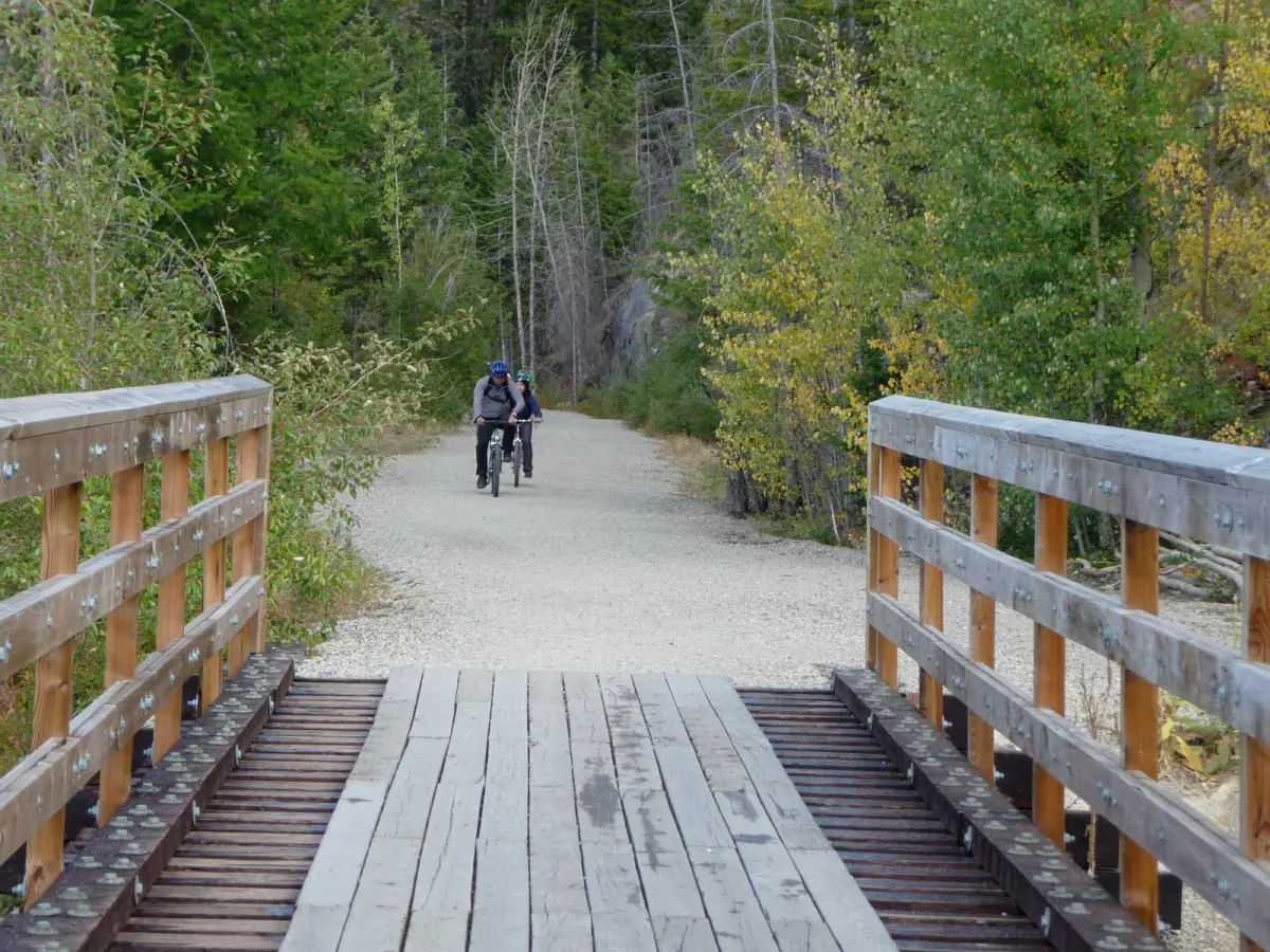
The ride most visitors choose runs from Penticton through the wine country toward Naramata and the Little Tunnel. It is about 16 km one way and about 32 km return, at roughly 1 to 1.5 hours per direction.
Our picks: Kettle Valley Rail Trail rides
The Myra Canyon day is the guided choice and adds winery tastings, while the self-guided ride suits you if you want to set your own pace. The corridor between Summerland and Banbury Green is closed, so neither tour should be read as a through-ride there.
Hand-picked tours, booked through GetYourGuide. Prices are indicative starting prices in US dollars (as of October 2026). Tap a tour for live availability and the current price in your currency.
Myra Canyon bike and wine tasting day
- Bike and helmet
- Guide
- Tasting fees
A guided day that combines a bike ride at Myra Canyon with winery tastings. This is a Myra Canyon trip, not a ride along the closed Summerland section.
Check availability →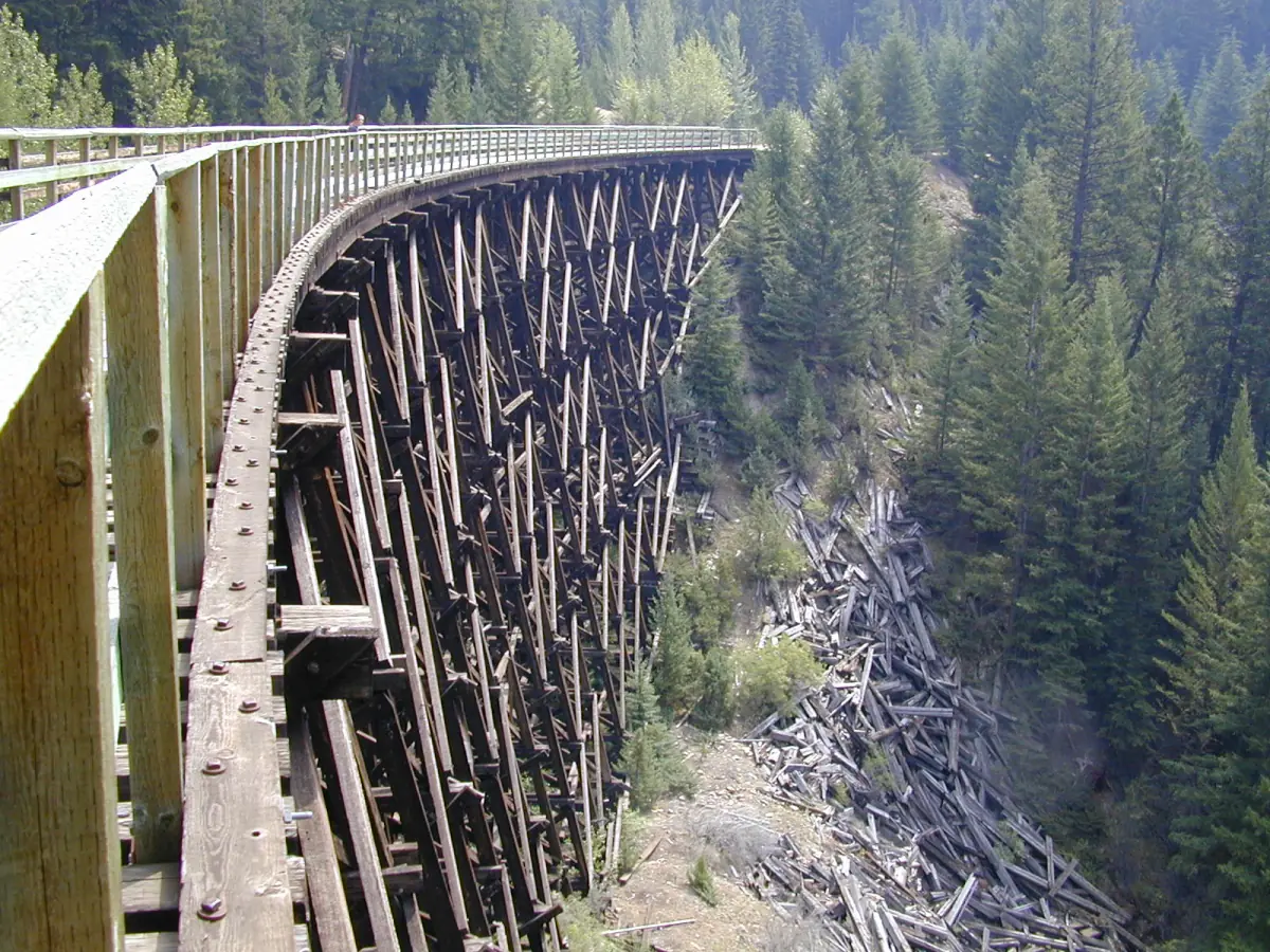
Historical trail by bike, self-guided
- Bike and helmet
- Repair kit and first aid
- Transfer from your accommodation
You ride on your own with a bike, helmet, repair kit and first-aid kit, and the transfer to and from your accommodation is included. Ask before booking which sections are open; the corridor between Summerland and Banbury Green is closed.
Check availability →Kettle Valley Rail Trail rides and bike tours
Guided bike rides, e-bike outings and wine-country cycling from Penticton, with live prices and availability.
The Kettle Valley Railway and the trail today
Penticton was named the railway's headquarters in 1910, and construction ran from 1910 to 1915. The railway no longer runs as a passenger line. Its route became a trail, and in Myra-Bellevue Park it is part of the Trans Canada Trail.
Do not expect one evenly surfaced route from end to end. Treat each section as its own outing and check its status first.
Penticton to Naramata and the Little Tunnel
This is the easiest section to plan. The trail passes through vineyards above Okanagan Lake and reaches the Little Tunnel after about 16 km. Allow around 1 to 1.5 hours each way, depending on your pace. It is an out-and-back ride, not a loop.
Detours to tasting rooms may leave the old railway bed, so do not assume the whole day is flat or car-free. If you plan to taste wine, read the Naramata Bench guide and keep alcohol and cycling apart. Check where you can hire bikes before the day you want to ride.
Myra Canyon
Myra Canyon is a stretch of its own. The core section is 8.8 km with 16 timber trestles, 2 steel bridges and 2 tunnels. The trip between the Myra and June Springs access points is about 12 km. A forest fire in 2003 damaged the trestles, and a reopening ceremony took place on 22 June 2008.
To reach the Myra parking area, you drive about 8 km of partly rough gravel road from McCulloch Road. On the trestles, push your bike, wear a helmet and give way to walkers and horses. Motor vehicles are not allowed on the canyon section, and dogs must be on a leash. Plan Myra Canyon as a separate day rather than an add-on to a Penticton ride. If you want to continue north, the Okanagan Valley overview covers the wider region.
Closures and the Adra Tunnel in 2026
The corridor owned by the Penticton Indian Band between Summerland and Banbury Green has no public access because of rockfall, unstable slopes and other hazards (status of 10 June 2026). The footpath along the river channel is the exception. Do not go around barriers, and do not look for a route across reserve land.
The Adra Tunnel was closed for construction in early May and then fully reopened on 26 May 2026. A celebration took place on 23 September 2026.
After the wildfire in August 2026, Summerland closed further sections (status of 21 August 2026). The Trans Canada Trail from the Rodeo Grounds toward Faulder is closed, while Fenwick Road to the Rodeo Grounds and Conkle Mountain Park remain open. These closures are separate from the closure of the Penticton Indian Band corridor. Do not assume that every other section is open: check the current notices of the park or municipality before each ride.
Sections compared
Status as published for 2026. Check before you ride.
| Section | Length | Status in 2026 |
|---|---|---|
| Penticton to the Little Tunnel | About 16 km one way | Popular out-and-back ride |
| Myra Canyon core | 8.8 km | 16 timber trestles, 2 steel bridges, 2 tunnels |
| Summerland to Banbury Green (Penticton Indian Band corridor) | – | No public access |
| Adra Tunnel | – | Reopened 26 May 2026 |
| Rodeo Grounds toward Faulder | – | Closed after the wildfire |
For most visitors, the out-and-back ride to the Little Tunnel is the simplest plan, with Myra Canyon as a separate day by car. If you want a shorter outing on foot instead, see hiking around Penticton, or read about Summerland and the history of the railway.
Kettle Valley Rail Trail: frequently asked questions
How long is the ride from Penticton to the Little Tunnel?
About 16 km one way and 32 km return. Allow roughly 1 to 1.5 hours per direction.
Can I ride the whole Kettle Valley Rail Trail?
No. The corridor between Summerland and Banbury Green has no public access, and other sections have closures. Ride the sections that are open.
Is the Adra Tunnel open?
Yes. It was fully reopened on 26 May 2026 after a short closure for construction.
What are the rules in Myra Canyon?
Push your bike across the trestles, wear a helmet, give way to walkers and horses and keep dogs on a leash. Motor vehicles are not allowed in the canyon section.
Does the trail pass any vineyards?
The ride from Penticton passes through the Naramata Bench vineyards. Read the Naramata Bench guide for tasting basics and safe transport.
How long is the Myra Canyon trip?
The core stretch is 8.8 km. The trip between the Myra and June Springs access points is about 12 km.